
GPS navigation in Jamaica is getting better and better!
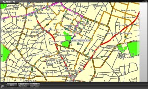 I mentioned in an earlier post that GPS navigation in Jamaica is finally available. Since then, there’s been a flurry of developments! GPS navigation is now available on most smartphones (only BlackBerry phones, for now, aren’t compatible), and new features in the system include environmental data (the national parks and protected areas, trails, caves); corporate logo identification, opening hours and contact information; and offshore marine data (including all reefs, banks, shoals and cays off our coastline).
The developers have really gone all-out on this thing. They’ve added 25% more roads and dozens of new points of interest.
But it’s the feedback that’s been the most impressive. I’ve met so many satisfied customers and people who never believed this product would be this good. So many people dismissed it as a Kingston-only device. Others dismissed it off-hand because they already claim they know where everything is Jamaica was. But because of the device’s multi-purpose functionality, it doesn’t have to be exclusively used as a navigation-only tool. And people realize this.
And it’s the customer service people experience on the phone or at the offices of the developers – MonaGIS. Staff there talk prospective customers through the different options, and provide ready assistance to existing customers.
I know what I’m going to be giving as gifts this Christmas!
Older Posts
- The shrinking widening world
- Style, no substance; Substance, no style; no Style no Substance
- Response after the Response
- World Cup Reality Check
- Energy Challenges
- Top Jamaican Scientists
- The Annual 12-Month Hazards Season
- A blog about blogs
- Playing to our Strengths
- Deep Sea Nightmare
Other Blogs

Social Bookmarks
Bookmark this:


| M | T | W | T | F | S | S |
|---|---|---|---|---|---|---|
| «-» | ||||||
| 1 | 2 | 3 | 4 | 5 | ||
| 6 | 7 | 8 | 9 | 10 | 11 | 12 |
| 13 | 14 | 15 | 16 | 17 | 18 | 19 |
| 20 | 21 | 22 | 23 | 24 | 25 | 26 |
| 27 | 28 | 29 | 30 | 31 | ||
- Gleaner Company Websites
- Jamaica Gleaner
- The Star
- Go Jamaica
- Go Local
- Sports Jamaica
- Sports Caribe
- Hospitality Jamaica
- Youth Link
- Voice UK
- Gleaner Company Websites
- Business Directory
- Gleaner Classifieds
- Kingston Restaurant Week
- Financial Gleaner
- Discover Jamaica
- Discover Caribe
- Returning Residents
- Go Jamaica hosting
- Contact Info
- RSS Feed
- Contact Us